
September 17, 2024
2 min read
Why Have Record-Breaking Rains Drenched the Carolinas and Europe?
On opposite sides of the Atlantic Ocean, Central Europe and North Carolina have both been drenched by torrential rains
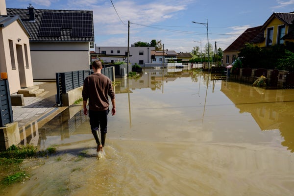
A man walks on a flooded road after heavy rain on September 17, 2024 in Moosbierbaum, Austria.
Christian Bruna/Stringer/Getty Images
Both Central Europe and eastern North Carolina have seen torrential downpours and devastating flooding in recent days—with 18 inches in certain locations of each region.
The deluge began on September 13, dousing countries that include Austria, Poland, Romania and the Czech Republic, where a couple of cities reported 18 inches of rain over the weekend. At least 22 people have died. Even as the rain continued to fall in Europe, across the Atlantic Ocean, another storm began to drench the eastern Carolinas and Virginia. Some areas saw more than a foot of rainfall within 12 hours on September 16, soaking a region that has still been recovering from Tropical Storm Debby in early August.
Why has there been so much rain? Scientists point to two separate, unusual phenomena that have been playing out on opposite sides of the Atlantic.
On supporting science journalism
If you’re enjoying this article, consider supporting our award-winning journalism by subscribing. By purchasing a subscription you are helping to ensure the future of impactful stories about the discoveries and ideas shaping our world today.
In Europe, the record rains fell because of what meteorologists call an atmospheric block. Under normal conditions, a powerful corridor of strong wind called the jet stream rings the Arctic, blowing more or less west to east. Usually the jet stream wanders northward and southward, depending on conditions, but sometimes the phenomenon becomes particularly pronounced.
“Those meanders get really amplified,” says Tim Woollings, an atmospheric scientist at the University of Oxford. When that happens, the jet stream also tends to stall, which can leave weather systems stuck in place. When those systems contain lots of water vapor, the result is often heavy precipitation, he says.
Atmospheric blocks “are semi-rare events—we would expect to get an event like this maybe once or twice every season,” Woollings says. “It’s a slightly unusual weather pattern, but it does happen.”
The U.S. rainfall unfolded differently, without an atmospheric block, says Noboru Nakamura, an atmospheric scientist at the University of Chicago. Instead the Carolinas were drenched by a rare flip in the direction of predominating wind.
Usually, weather systems in the U.S. move from west to east, just as the jet stream does. Nakamura says that low-lying winds over the Carolinas reversed and blew from east to west, however, because of interference from a high-pressure system located farther north. “This is an unusual situation,” he says. “This was definitely anomalous.”
In both regions, warm sea-surface temperatures—in the Mediterranean and Black Seas for the European rains and in the Atlantic Ocean for those that occurred in the eastern U.S.—allowed each storm to pick up high amounts of water vapor, contributing to the severity of the rainfall and associated flooding. Scientists worry that storms with such intense effects will become more frequent as the climate continues to change.
The statistics right now are too complicated to determine whether atmospheric blocks like the one that drenched Central Europe will become more common with climate change, Woollings says. The consequences of such blocks will likely become more serious, however, as warmer air that can hold more water vapor becomes more prevalent.
“These types of events aren’t going to go away in the future,” Woollings says. “The impacts of them are just going to get worse as we get more sensitive to the heat waves and more sensitive to the flooding.”